Have you ever wondered how technology transforms the way we see the world around us, particularly in fields like surveying? In this era of rapid technological advancements, traditional methods of data collection are being revolutionized by drone mapping. This article delves into understanding drone mapping, exploring where it is applied, and why it’s considered a revolutionary advancement in the surveying industry.

What is Drone Mapping?
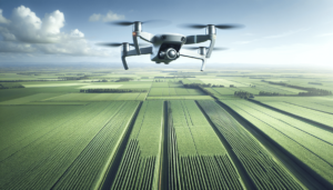
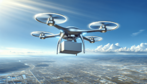
Drone mapping refers to the use of unmanned aerial vehicles (UAVs), commonly known as drones, equipped with high-resolution cameras and sensors, to capture aerial data. This data is then processed to create precise maps or 3D models of the terrain. The process essentially involves capturing numerous overlapping images from different angles and stitching them together to form a comprehensive and detailed map.
The Technology Behind Drone Mapping
The technology that facilitates drone mapping is a confluence of aviation, photography, and data processing software. A drone equipped with GPS, cameras, and various sensors captures data that is later processed using photogrammetry software. This software employs complex algorithms to convert two-dimensional images into three-dimensional models, providing accurate spatial information.
Drone mapping employs several types of sensors, including:
| Sensor Type | Description |
|---|---|
| RGB Cameras | Capture images in red, green, and blue wavelengths for high-resolution maps. |
| Multispectral | Measures different wavelengths of light to analyze health of vegetation. |
| LiDAR | Uses laser pulses to measure distances and create precise topographic maps. |
| Thermal Sensors | Detect heat and are used for thermal mapping and monitoring energy efficiency. |
How Drone Mapping Works
The process begins with planning a flight path using specialized software considering factors such as altitude, overlap, and area coverage. The drone then follows the predetermined path to capture images. Once the data is collected, it is processed to create accurate maps. This digital output can then be used for analysis in various applications like urban planning, agriculture, or construction.
Applications of Drone Mapping
Drone mapping is a versatile tool with applications spanning multiple industries. Let’s explore some of the key sectors where it is making a significant impact.
Construction Industry
In the realm of construction, drone mapping is indispensable for project monitoring, site surveys, and infrastructure inspection. It aids in:
- Project Planning and Management: Provides accurate site data for planning and tracking progress.
- Safety Inspections: Enables inspections of high-risk areas without endangering personnel.
- Volume Calculations: Helps in calculating material volumes, which is critical in earthworks.
Agriculture
Precision farming is another arena where drone mapping is a game-changer. It allows farmers to:
- Assess Crop Health: Use multispectral sensors to monitor plant health and detect issues early.
- Optimize Irrigation: Analyze thermal maps to improve water management.
- Monitor Soil Conditions: Utilize topographic data to understand soil variation and adjust farming practices.
Environmental Conservation
Drones contribute significantly to environmental monitoring and conservation efforts. They are used to:
- Map Wildlife Habitats: Monitor changes in ecosystems and wildlife populations.
- Conduct Environmental Impact Assessments: Evaluate the impacts of construction projects on the environment.
- Monitor Deforestation: Track changes in forest cover and assist in reforestation efforts.
Urban Planning
Urban planners leverage drone mapping for:
- Site Analysis: Provide detailed imagery and models for city development projects.
- Infrastructure Maintenance: Monitor wear and tear in urban infrastructure.
- Disaster Response: Assist in assessing damage and planning recovery efforts post-disaster.

Advantages of Using Drone Mapping
The integration of drone mapping into surveying introduces several advantages over traditional methodologies. These include:
- High Efficiency and Cost-Effectiveness: Surveys that took days can now be completed in hours, reducing manpower and associated costs.
- Enhanced Accuracy: Drones provide high-resolution data, improving the precision of maps.
- Inaccessibility Made Accessible: Drones can access hard-to-reach areas, capturing data that was previously difficult or dangerous to obtain.
- Rapid Data Delivery: Quick data acquisition allows for faster decision-making and project execution.
Challenges and Considerations
While drone mapping offers a plethora of benefits, there are challenges and considerations to address:
- Regulations and Compliance: Operators must adhere to aviation regulations that can vary significantly across regions.
- Weather Dependence: Adverse weather conditions can obstruct data collection, affecting the quality and consistency of the output.
- Data Processing Requirements: Processing large volumes of data requires powerful software and computing resources, which can be costly.
The Future of Drone Mapping
The future prospects of drone mapping in surveying and other industries appear promising. With continuous advancements in technology, drones are becoming more efficient, autonomous, and equipped with improved sensors and software. This progress indicates a trend toward increased adoption and integration of drones in various applications, further solidifying their role as game-changers in surveying.
Emerging Trends
- AI and Machine Learning Integration: These technologies enhance the capability of drones to analyze data and provide actionable insights autonomously.
- Increased Autonomy: Autonomous drones reduce the need for manual control, allowing for more complex missions and broader applications.
- Enhanced Battery Life and Range: Technological advancements leading to improved battery life and range extend the operational capabilities of drones.
Conclusion
Understanding drone mapping reveals its transformative impact across various sectors, especially surveying. It introduces a new paradigm, characterized by efficiency and accuracy, disrupting traditional practices. As technology continues to evolve, the potential applications and benefits of drone mapping are likely to expand, further cementing its place as an indispensable tool in modern surveying practices. It is an exciting time for innovation and adoption in this field, promising improved outcomes and efficiencies for industries worldwide.