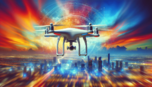
Is technology changing the way we respond to disasters? In recent years, drones have emerged as a pivotal tool in disaster relief efforts. Their versatility and efficiency have shifted paradigms, offering innovative solutions where traditional methods lag behind. Driven by advances in technology, drones—or unmanned aerial vehicles (UAVs)—are transforming how rescue operations are conducted. But what lessons have we gleaned from their deployment in recent disasters? In this article, I aim to provide a comprehensive overview of how drones have been utilized in disaster scenarios and what these experiences teach us about their future use.

Understanding the Role of Drones in Disaster Relief
Before diving into specific case studies and lessons, it is important to lay the groundwork by understanding how drones function in the context of disaster relief. These aerial machines, remotely piloted or programmed to fly autonomously, serve a myriad of purposes during emergencies.
Why Use Drones?
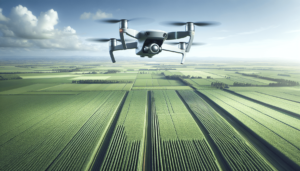
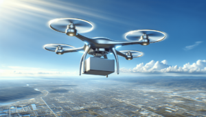
Drones offer real-time data and access to areas where human entry might be limited or dangerous. They can evaluate damage, map affected areas, deliver supplies, and assist in search and rescue operations. Their ability to fly quickly and efficiently over disaster-stricken areas makes them indispensable in saving lives and resources.
Features That Enhance Rescue Operations
The technology embedded in drones is a crucial factor in enhancing their utility. Equipped with high-resolution cameras, sensors, and GPS systems, they can capture detailed imagery and send it to ground teams, facilitating rapid decision-making and resource allocation.
Recent Case Studies in Drone-Assisted Disaster Relief
Examining specific instances where drones were employed to manage disasters provides critical insights into their strengths and limitations. Here are several recent examples:
Hurricane Florence – United States
In 2018, Hurricane Florence caused widespread flooding in North Carolina, submerging roads and isolating communities. Drones played a vital role in assessing affected areas. Operated by the Federal Emergency Management Agency (FEMA), they identified which roads were navigable and which neighborhoods required immediate attention. These efforts expedited the delivery of supplies to stranded residents.
Nepal Earthquake
The devastating earthquake in Nepal in 2015 demonstrated the utility of drones in a mountainous terrain. Teams deployed UAVs to map remote villages, providing up-to-date information that traditional reconnaissance methods could not match. This mapping was instrumental in planning relief missions and understanding the extent of infrastructural damage.
Australian Bushfires
In the 2019-2020 Australian bushfires, drones were used to monitor the spread of fires and locate hotspots. They mapped large areas affected by smoke and flames, contributing essential data to firefighting strategies. These efforts exemplified how technology could complement human efforts in massive, environmental crises.

Lessons Learned from Drone Deployments
Each disaster provides unique learning opportunities. The deployment of drones in these scenarios offers multiple takeaways:
Lesson 1: The Importance of Coordination
Coordination between various agencies is crucial. In the aftermath of Hurricane Florence, it was clear that effective communication between local authorities and federal agencies enhanced the impact of drones. Harmonized efforts ensured that drone data led to swift, actionable responses.
Lesson 2: Technological Adaptability
Adaptation of drone technology for specific environments is necessary. The Nepal Earthquake highlighted that drones must be equipped to handle the geographical challenges of the landscape they operate within. This requires not only advanced technology but also skilled operators who can maximize the UAV’s potential.
Lesson 3: Ethical Considerations and Privacy
While drones offer unparalleled advantages, their use raises ethical concerns, particularly concerning privacy. During missions, it is vital to balance the need for information with the rights of individuals in affected areas. Establishing clear guidelines on data collection and usage is imperative.
Lesson 4: Overcoming Regulatory Challenges
Navigating regulatory frameworks can be complicated. Each country has its own rules governing airspace and UAV use. Successful disaster relief efforts necessitate a thorough understanding of these laws to prevent legal hurdles from delaying crucial interventions.
Challenges Facing Drone Use in Disaster Relief
Despite their potential, drones face several hurdles in their application. Addressing these issues is key to enhancing their effectiveness in future relief efforts.
Technical Limitations
Current drone models have limitations, such as battery life and load capacity, which restrict their operation time and the volume of supplies they can transport. Innovations in energy storage and aerodynamic design could extend these capabilities.
Training and Expertise
The operation of drones demands a high level of expertise. Training individuals to not only fly these machines but also interpret the data they capture is crucial. Establishing training programs that emphasize both technical and analytical skills can bridge this gap.
Cost Considerations
The expense of deploying drones, from procurement to maintenance, remains a significant barrier. Investment in this technology needs to be weighed against its benefits, with considerations for budget allocations and funding sources.
Future Prospects: Evolving Drone Technologies
The future of drone integration in disaster relief depends largely on technological advancements and evolving practices. Anticipating these changes can better prepare us for their wider adoption.
AI and Machine Learning
Integrating artificial intelligence and machine learning can enhance drones’ predictive capabilities, allowing them to analyze patterns and predict disaster impacts before they escalate. Such advancements promise more proactive and informed responses.
Enhanced Autonomy
The development of more autonomous drones could lessen reliance on skilled operators. Drones capable of making real-time decisions based on pre-set parameters can extend their usability in crises.
Networked Swarm Drones
The concept of swarm drones—multiple UAVs working in unison—offers exciting possibilities. These networks could cover larger areas more efficiently, providing comprehensive data that supports large-scale disaster management strategies.
Conclusion
Reflecting on the lessons from recent disasters, drones have undeniably cemented their position as vital assets in relief operations. However, realizing their full potential requires addressing existing challenges and embracing technological advancements. As we look to the future, these aerial vehicles promise to further transform the landscape of disaster response, offering hope and a tangible path to minimizing human and material losses in crises. In the evolving discourse of disaster management, the integration of drones stands not just as evidence of technological progress, but as a beacon of how we might navigate the unpredictable forces of nature.