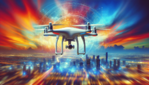
What if drones could revolutionize urban living as we know it? As an urban planner in this rapidly evolving age of technology, I often find myself pondering the transformative potential of emerging innovations. Among these, drones stand out as a particularly fascinating technological development. Far from being the exclusive domain of hobbyists or cinematic productions, drones are increasingly becoming pivotal tools in the realm of urban planning and inspections.

The Drone Revolution: An Overview
Drones, or unmanned aerial vehicles (UAVs), have seen explosive growth over the last decade. Initially sparked by military applications, their use has diversified significantly. These compact flying machines come equipped with high-resolution cameras, sensors, and sometimes even advanced communication systems. Their capability to hover, maneuver with precision, and capture detailed aerial views has positioned them as invaluable assets across numerous sectors.
In the urban context, their applications are both diverse and compelling. From emergency response to infrastructure inspections, drones offer a unique vantage point that can yield new insights into city planning and management.
The Role of Drones in Urban Planning
Aerial Mapping and Surveys
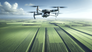
At the heart of urban planning lies the need for accurate data. Traditional surveying methods, while reliable, can be time-consuming and costly. Enter drones—able to quickly carry out aerial mapping with a level of detail that rivals, and sometimes surpasses, conventional approaches. By employing photogrammetry and LiDAR technology, drones can create high-resolution topographic maps, 3D models, and even digital twins of our cityscapes.
For example, when assessing potential sites for new developments, drones can swiftly provide planners with crucial information about terrain, existing structures, and potential environmental impacts. In this way, drones facilitate more informed decision-making, potentially leading to better urban outcomes.
Monitoring Construction Progress
In the dynamic world of construction, staying on schedule and within budget is paramount. Drones have emerged as essential tools in tracking the progress of construction projects. Regular flyovers can capture consistent and up-to-date imagery, allowing project managers to monitor construction phases meticulously.
Continuous drone surveillance ensures that any deviations from planned timelines or designs are detected early on. This not only helps mitigate potential delays but also enhances communication between stakeholders, as real-time updates can be seamlessly shared.
Environmental Monitoring and Management
Our cities are not isolated entities but part of broader ecosystems. Understanding the environmental impacts of urban developments is thus crucial. Drones equipped with environmental sensors can monitor air and water quality, detect heat islands, and even assess the health of green spaces.
By providing continuous and detailed environmental data, drones enable city planners to implement more sustainable practices. For instance, they can identify areas where green infrastructure is most needed or assess the effectiveness of current environmental policies.

Inspections: Ensuring the Vitality and Safety of Urban Spaces
Infrastructure Inspections
Urban infrastructure is the backbone of any city. Whether we talk about bridges, roads, or utility lines, maintaining these structures is vital for the safety and quality of urban life. Drones, with their ability to access hard-to-reach places, offer an unprecedented advantage in inspection processes.
Equipped with high-resolution cameras and sensors, drones can quickly assess the condition of infrastructure. This capability not only speeds up the inspection process but also reduces the risk to human inspectors, who would otherwise need to physically examine dangerous locations.
Here’s a simple table illustrating some key benefits of using drones for urban infrastructure inspections:
| Benefit | Description |
|---|---|
| Safety | Reduces need for risky manual inspections |
| Speed | Significantly faster than traditional methods |
| Cost-Efficiency | Lower operational costs compared to manned inspections |
| Accessibility | Capable of reaching difficult or hazardous locations |
| Detailed Data Collection | High-resolution imagery and advanced sensors provide comprehensive data |
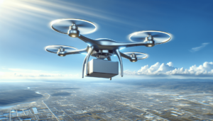
Emergency Response and Disaster Management
In times of crisis, rapid response can save lives. Drones have proven vital in emergency scenarios, providing real-time visuals of affected areas and aiding in the delivery of supplies. Their ability to survey disaster zones quickly is invaluable, offering first responders critical insights into the severity of the situation and assisting in the coordination of aid efforts.
Furthermore, in the aftermath of disasters, drones can facilitate damage assessments and infrastructure evaluations, accelerating the recovery process and ensuring efficient resource allocation.
Challenges and Considerations
Regulatory Landscape
Despite the clear advantages, the integration of drones into urban planning and inspection is not without its challenges. One major hurdle is the evolving regulatory environment. Navigating airspace regulations, ensuring compliance with privacy laws, and dealing with the bureaucratic red tape can often impede drone operations.
Countries and cities have established various rules governing drone usage, which can vary significantly. Understanding these regulations and working within them is essential for any urban entity seeking to leverage drones.
Privacy Concerns
Drones, by their very nature, can penetrate private spaces, raising valid privacy concerns. How can we strike a balance between gathering necessary data and respecting individual privacy rights? This question is pivotal in public acceptance and the ethical deployment of drone technology.
Urban planners and policymakers must engage with communities to address these concerns proactively. Establishing clear guidelines on data use, access, and storage is imperative to reassure the public about the implications of drone operations.
Technical Limitations
While technologically advanced, drones are not without their limitations. Weather conditions can severely affect their operations, and their range and battery life impose additional restrictions. Furthermore, the potential for technological malfunctions cannot be overlooked, necessitating robust risk management strategies.
Future Prospects: From Concept to Reality
Smart Cities and IoT Integration
Drones are not standalone solutions but can integrate effectively with broader technological ecosystems like the Internet of Things (IoT). In smart cities, drones can work in tandem with IoT devices to monitor and manage urban environments dynamically.
Imagine a future where drones can autonomously monitor traffic conditions, coordinate with smart traffic lights, and relay information to autonomous vehicles, creating a seamless urban mobility experience. While still conceptual, such possibilities are on the horizon, given the rapid advancements in drone technology and smart city frameworks.
Participatory Planning
Drones can also democratize urban planning by involving citizens in the process. Through aerial imagery and virtual simulations, communities can visualize proposed developments, providing feedback and actively participating in the planning process.
This participatory approach not only empowers citizens but also fosters collaboration between planners and communities, resulting in developments that more accurately reflect community needs and values.
Conclusion: Towards a Drone-Enhanced Urban Future
The question remains: can drones fix our cities? While they are not a panacea for all urban challenges, drones undeniably offer tools that can significantly enhance urban planning and inspections. By providing new perspectives, accelerating data acquisition, and improving processes across the urban spectrum, drones are helping us reimagine what our cities can be.
As we navigate the complexities of urban life, the thoughtful integration of drones into planning and inspection processes has the potential to transform urban environments sustainably and efficiently. Collaboration, innovation, and responsible implementation will be key as we harness the full potential of this technology to address the ever-evolving challenges posed by modern urbanization.